
Riding Johnson Canyon Road (Utah) on a Gravel Bike
A solo dawn ride up Glendale Bench and Johnson Canyon Road near Kanab, Utah — a brutal 1,500-foot gravel climb rewarded with the backside of Bryce, Grand Staircase-Escalante, white canyon bluffs, and a Gunsmoke ghost town.
This post contains affiliate links. If you buy through our links, we earn a small commission at no extra cost to you. Thank you!
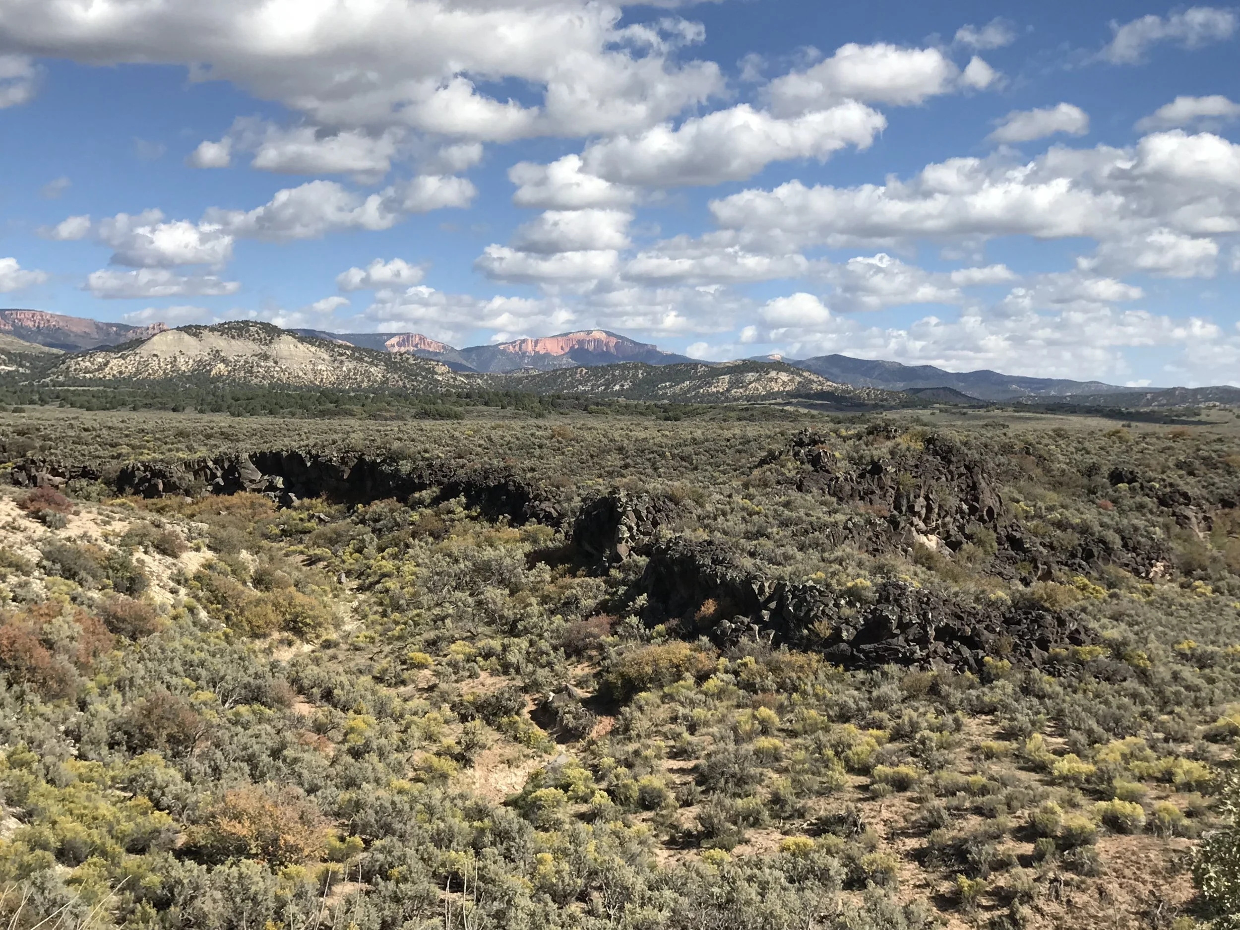
A brutal climb on chunky gravel led to expansive views.
When I was a kid, I used to look out at the odd road or random trail disappearing into the countryside as our family car passed on the highway and wonder… “where does that go?” As I got older and found myself with my own car, backpack, and bike, I realized I could finally explore some of those whims. With that delight, I also quickly learned that a little bit of a plan goes a long way — and that learning a route ahead of time, to plan food, water, and supplies, could keep the adventure going.
When Matt, our Dude, the pets, and I pulled into a campsite at Bauer’s Canyon Ranch RV Park in Glendale, Utah — north of Kanab — we delighted in the apple trees dropping fruit all around us in the old orchard. While walking the dogs morning and evening, one road kept grabbing my attention. On its west end it’s called Glendale Bench Road, and by the time it winds east, then south, it ends about 34 miles later on Highway 89, just east of Kanab.
It’s an unsuspecting-looking road, starting with nearly fist-sized gravel and heading straight up the “bench” from the town of Glendale. There wasn’t much written about it at the time, but I couldn’t resist — so I started googling it, looking at maps and satellite images, and decided I needed to ride this stretch on my bike.
I had no idea what I was in for.
On the day I departed, I left just as the sky was lightening. I packed my normal riding kit — water, food, energy chews, tools, and a flat-repair kit — but because it was remote, I also took a walkie-talkie (we didn’t have the Garmin inReach yet, and I definitely would have brought it on this ride), a headlamp, an external battery charger, an extra layer, and offline maps downloaded so I could access them without signal.
Matt and I made our plan: I’d head out and ride for a few hours, and he and Eric would have an easy morning and then take the truck up the same route to see when and where they’d catch me. I’m really glad we planned it this way, for two reasons. First, once I got a few miles out, I lost all cell signal and the walkie-talkies wouldn’t connect unless he was getting close. The second reason would come at the end of my ride.
Those first few miles were enough to make me question what in the world I was doing. In less than three miles, I climbed nearly 1,500 feet. I think I walked my bike as much as I rode it — the inclines were steep, followed by flatter sections, with plenty of “teaser” peaks: hills you climb hard thinking you’re almost there, only to reach a flat and see the next climb waiting. Ugh.
Once I finally reached the peak of the peak of the peak, the views opened up and I realized I was looking at the backside of Bryce Canyon National Park. The gravel at the start was brutal — huge chunky rocks that bounced everything and made it nearly impossible to ride in a straight line. But what I didn’t realize until I saw the sign was that I was about to ride straight into Grand Staircase–Escalante National Monument.
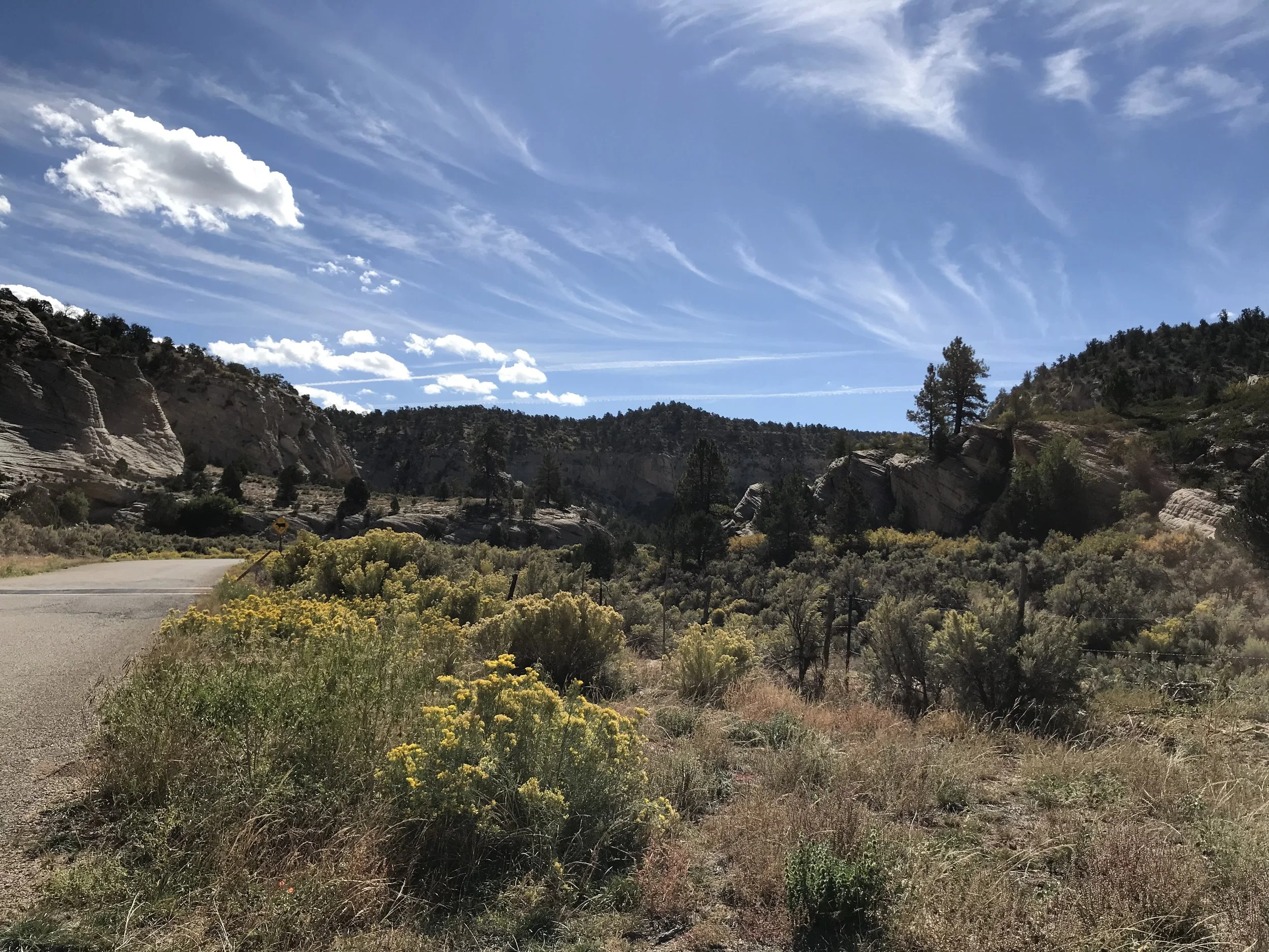
Almost instantly, the gravel got smaller, completely bearable, and a whole lot more fun. This section was beautiful, with vast stretches of views and small canyons starting to open up. At this point I was texting Matt to tell him to leave plenty of time to enjoy the drive — hoping the message would send if I picked up a whiff of cell signal.
This is clearly a popular area for off-road enthusiasts, too; many were packing up their ATVs, RVs, and campsites from the weekend and heading home as I rode past. But the beauty of this road wasn’t over.
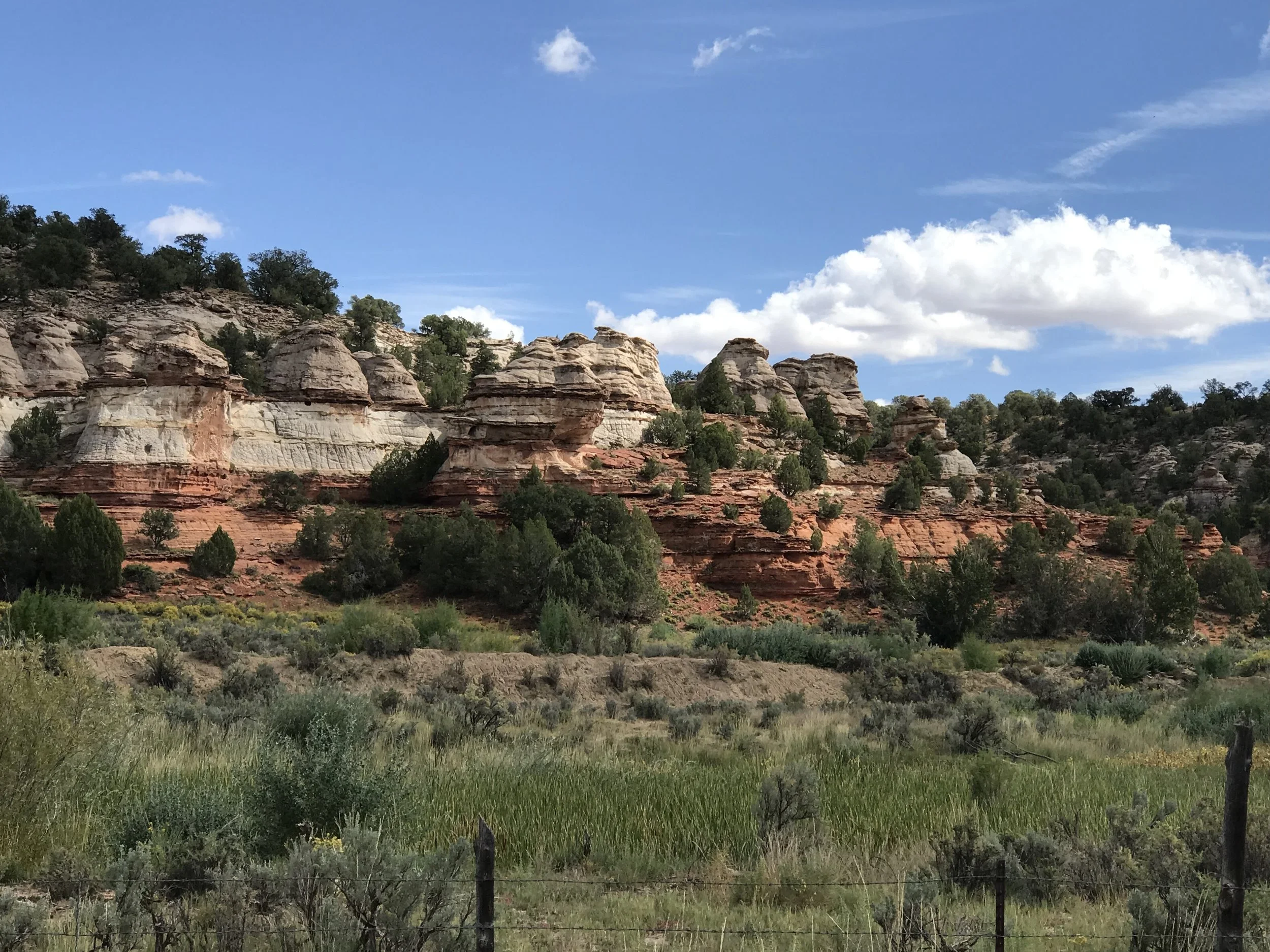
The brownish-red colors began to morph into chalky white rock outcroppings: I was entering Johnson Canyon. It’s an underrated drive — well, maybe not underrated, but definitely not talked about enough. Not only are the swirling white craggy bluffs easy on the eyes, but as I wound through farmland farther down the canyon, I stopped the moment I saw the wooden sticks of a ghost town. By then I had cell signal, and while I still hadn’t heard from Matt, I knew they’d have started by now. I googled where I was to learn the ghost town’s name — only to find it was the old movie set for Gunsmoke. It’s on private land, off-limits to curious tourists, but easy enough to see and photograph from the road.
Now came the hot stretch. Officially out of the rocky canyon and committed to a hot, straight, flat run of pavement through farmland, I sweat through my shirt while soaking up the colors, cows, and speed. This was when I caught sight of Matt and Eric, and we planned where to meet at the end of my ride.
Here’s where my second reason for appreciating a plan — and being willing to change it — comes in. From where Johnson Canyon Road empties onto Highway 89, it’s only about four miles into town. I figured I’d just ride the highway shoulder in and meet them at Willow Canyon Outdoor (a gear shop AND a coffee shop — can it get any better?). But once I rode out into the open, away from the canyon and valley, the wind picked up dramatically. I didn’t even mind the building rain, but as I entered the highway shoulder that strong wind became a crosswind. Add semis passing at 80 mph, with the push and suction of their wind currents, and riding the shoulder got sketchy fast.
Fortunately, Matt read the situation from the truck and stopped about a mile up the highway on a pullout to wait for me. I was happy to call it a day rather than get beat up by wind and traffic after an already epic — and tough — ride.
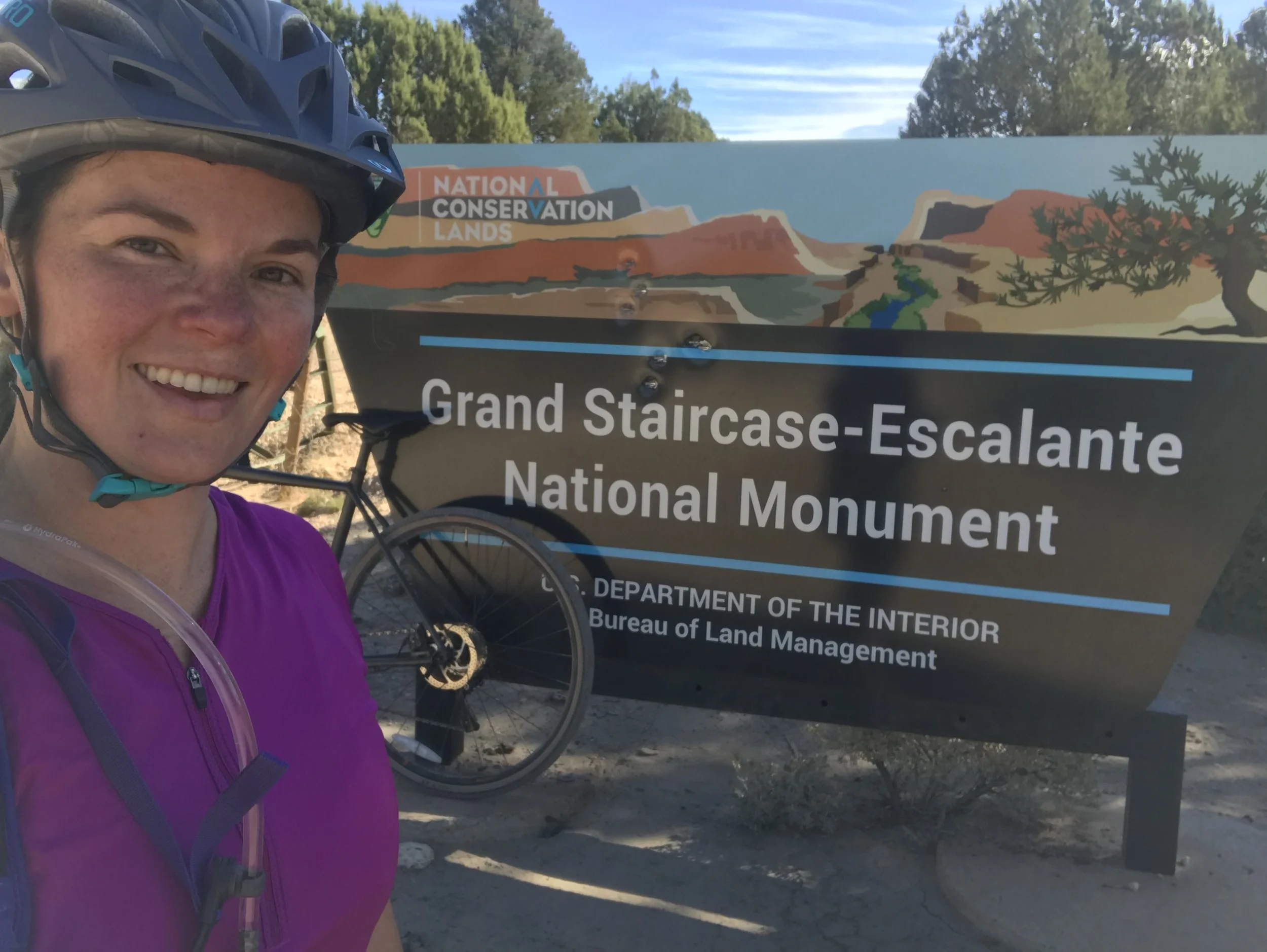
Would I do it again? If someone could drop me off after that first 1,400-plus-foot climb, you bet. Truly, though, this was a memorable, gorgeous backdrop for a gravel ride close to Kanab, with plenty of neat geology, public-land appreciation, wildlife, and history.
(Podcast) The Wonder of Monument Valley, Valley of the Gods, Bears Ears National Monument, + Durango, CO
Season 1, Episode 16: the remote wonders of Bears Ears, Monument Valley, Valley of the Gods, and Natural Bridges — boondocking, the treacherous Moki Dugway, and a finish in Durango, Colorado.
Season 1, Episode 16.
As we move on from Moab, we head to Bears Ears, Monument Valley, Valley of the Gods, and Natural Bridges National Monument, then on to Durango, Colorado.
If you’re going to visit this area, be prepared to be in a very remote place — pack accordingly and fuel up whenever possible. It’s a stunning part of America that’s only now really getting a lot of attention, with big vistas and natural wonders around every turn.
We boondocked at an abandoned airstrip we found using the Campendium app — what a great find: beautiful, uncrowded, with a view of Bears Ears and Natural Bridges. To be clear, it’s only a place to park your rig — no electricity, water, or septic — so come prepared to be self-sufficient.
Monument Valley is a Navajo Tribal Park, not a US park, with fantastic tours, hikes, and history; their website is the best resource and lists current conditions and closures. John Ford and John Wayne helped put this area on the map with beautiful old Westerns, and it’s continued into modern films — it’s one of the most iconic places in the American West. Valley of the Gods (not to be confused with Garden of the Gods in Colorado) is a stunning, often-overlooked area that’s free and accessible via a 17-mile gravel road, with remote camping, hiking, and photos galore. Just be very aware of the weather: it’s prone to flash flooding, which can come from rain falling miles away, uphill in the mountains. As always in country like this, take more water than you think you’ll need — enough for a couple of days if necessary. It can make the difference between life and death.
The Moki Dugway is about as treacherous a road as you’ll find — the most dangerous in Utah: narrow, with very tight switchbacks, and all gravel. It descends 1,200 feet from the mesa rim to the valley floor and will absolutely get your attention. Beautiful? Yes. Dangerous? You bet. Do not attempt it with large vehicles like RVs or while pulling a trailer.
Natural Bridges National Monument is one of the oldest national monuments (Theodore Roosevelt, 1908) and was once very hard to reach, until better roads were built in 1977. People have lived here since around 7,500 BCE — a stable desert water source with overhangs where they could build dwellings and granaries made it a good place to survive and thrive. Challenging hikes and beautiful rock formations make it a great place to explore.
Bears Ears National Monument has gotten a lot of press over the last few years, and was unfortunately reduced in size by 47% — a real shame. And then Durango, Colorado stole the show.
(Podcast) Magnificent Moab, Arches & Canyonlands National Parks, & Mountain Biking Heaven
Season 1, Episode 15: Moab, Utah — Arches and Canyonlands National Parks, the Adventure Mamas Dirtbag Family Bash, and mountain biking heaven.
Season 1 Episode 15, Magnificent Moab, finds us having way too much fun in Moab, Utah, exploring Arches National Park, partying with the Adventure Mamas Initiative during their Dirtbag Family Bash, and hitting the trail on some fantastic mountain bikes near Canyonlands National Park!
We talk about the Trail Forks App that helps you find fantastic trails with ratings, pictures, and off-line available maps so you don’t get lost.
For you hikers and runners out there, AllTrails is another app that we have found to be super useful when you are looking for some awesome hiking trails.
Of course, that doesn’t replace local knowledge, and you can get the best local knowledge for biking at Chili Peppers Bike Shop or Poison Spider Bikes (sweet name btw).
Hiking, climbing, camping, or need to do some laundry? Then Gearheads is your shop!
They even have free filtered water. We picked up a 5-gallon Scepter water container and flow-control spout to keep in the truck: it is great to have that added water insurance on our back country adventures. I can’t tell you how many times that has come in handy.
Moab is an unparalleled adventure locale for everything from climbing, 4X4 adventures, mountain biking, hiking, canyoneering, and of course whitewater paddling!
I have to admit, I found it very difficult to find an outdoor itch that you can’t scratch in this adventure mecca of the American West.
We even got to catch the Banff Mountain Film Festival (Eric’s first in-the-theater experience).
Referenced in this episode: Arches National Park, Canyonlands National Park, Adventure Mamas Initiative, Chili Peppers Bike Shop, Poison Spider Bikes, Gearheads Outdoor Store, Trail Forks, AllTrails, and the Banff Mountain Film Festival.
(Podcast) Visiting Bryce Canyon & Zion National Parks + Kanab, UT’s Movie History
Season 1, Episode 14: Kanab, Utah — Bryce Canyon and Zion National Parks, the Grand Staircase-Escalante, gravel biking on public lands, treasure digging, and Kanab’s movie history.
Season 1 Episode 14 finds us in Kanab, Utah, with plans to visit Bryce Canyon National Park and then Zion National Park — but along the way we discover so much more!
We find ourselves on the doorstep of the Grand Staircase-Escalante! Of course, Cristen has to go on a gravel biking mission to explore this amazing part of America’s public lands.
We also find ourselves digging for treasure and exploring the rich movie history around and in Kanab, Utah.
This is our longest episode yet, and for good reason: there’s so much to cover that we just couldn’t stop! We really hope you get the bug to explore this American treasure for yourself.
Referenced in this episode: Willow Canyon Outdoors, The Rock Stop, and Patagonia Activism.